

Designing Safer Streets and Services for Women

Qualified review required before publication: This draft is general education, not location-specific medical, public-health, legal, emergency, transport, building, electrical, environmental or engineering advice. Qualified local professionals, responsible authorities and safeguarding editors must review it before publication or implementation.
Rights, safety and privacy: Local law, hazards, standards and services vary. Protect personal information, obtain informed consent before sharing identifiable circumstances, and do not use this article as universal operational guidance. The example below is an illustrative composite and describes no real person, programme, partner or outcome.

Designing Safer Streets and Services for Women is ultimately a question about how a place works in daily life. A policy, building, route, park or digital system can look successful at city scale while excluding people in particular neighborhoods. A credible approach examines location, cost, reliability, safety, accessibility, environmental burden and influence over decisions—not merely whether an asset exists.

Sustainable Development Goal 11 connects safe and affordable housing, transport, participatory planning, heritage, disaster risk reduction and environmental impact. UN-Habitat, UNDRR, WHO urban-health resources, UNEP cities work and World Bank urban-development guidance provide complementary institutional perspectives. Global frameworks should be interpreted through current local evidence, law and professional standards.

“Designing Safer Streets and Services for Women succeeds when a city improves everyday access without transferring cost, risk or voice away from the people it serves.”

The systems behind this urban challenge

For this topic, a strong starting point is safe, affordable and accessible mobility that connects people to jobs, education, care and public life while reducing environmental harm. Sustainable urban development is not a collection of isolated projects. Land use changes travel demand; transport shapes access to work and care; housing location influences exposure and household cost; public space affects belonging; and infrastructure performance depends on maintenance, institutions and trust.

The question behind safer streets and services for women should therefore be precise: which residents face which barrier, in what place, and which accountable institution can change it? The answer may involve immediate service improvement, long-term regulation, capital investment or community stewardship. Naming the level of action prevents a temporary activity from being presented as structural reform.

Equity matters because people do not experience a city from the same starting point. Income, age, gender, disability, language, tenure, work schedule and caring responsibilities influence whether an apparently available service is genuinely usable. Disaggregate evidence proportionately, protect privacy and combine it with voluntary resident insight so averages do not erase lived conditions.

From consultation to accountable delivery

Work on safer streets and services for women should begin by mapping the existing system: formal rules, informal practices, public responsibilities, market incentives, community assets and environmental constraints. Identify what can be changed within a year and what requires a longer statutory or infrastructure process. Keep the public record clear about trade-offs and uncertainty.

  • Design with women, children, older adults and persons with disabilities: name a responsible institution, provide resources and create an accessible route for feedback or remedy.
  • Measure door-to-door access rather than route coverage: name a responsible institution, provide resources and create an accessible route for feedback or remedy.
  • Integrate fares, schedules and land use: name a responsible institution, provide resources and create an accessible route for feedback or remedy.
  • Use qualified local safety and engineering review: name a responsible institution, provide resources and create an accessible route for feedback or remedy.
  • Prioritize safe walking, cycling and public transport: name a responsible institution, provide resources and create an accessible route for feedback or remedy.

A readiness checklist

  • Define the concrete local outcome related to safer streets and services for women, not only the broad ambition.
  • Map who can access the place or service, who bears risk and who is absent from the evidence.
  • Invite residents into decisions early and resource their participation.
  • Check accessibility, affordability, safety, privacy, culture and applicable local standards.
  • Choose output, outcome, distributional and unintended-effect indicators before launch.
  • Assign an owner, maintenance resources and an accessible complaint or appeal route.
  • Publish limitations, learning and corrective decisions alongside progress.

A hypothetical neighborhood example

Picture a fictional district planning process focused on safer streets and services for women. Residents, frontline workers and technical staff agree on a shared problem statement, but they do not assume one solution. They compare options against affordability, safety, climate, accessibility and cultural continuity. The chosen pilot has a named owner, maintenance budget and stop criteria. Findings—including shortcomings—are made public. This composite reports no real beneficiary or programme.

The important feature is the sequence: define the local barrier, listen before selecting a solution, clarify responsibility, obtain qualified review where risk is involved, test a bounded change and compare outcomes across neighborhoods and groups. Replication should preserve principles but adapt the design to local law, climate, geography, culture and institutional capacity.

Mistakes that create new barriers

Common mistakes include removing car access before reliable alternatives exist, assuming infrastructure automatically changes travel behavior, and improving speed while weakening pedestrian safety. Teams also undermine credibility when they announce a model before establishing a baseline, count infrastructure without testing service quality, or celebrate total reach while ignoring people who cannot afford, enter, understand or safely use the intervention.

Indicators that support better decisions

Measurement should cover reach, quality, outcomes, distribution, safety and long-term value. Useful indicators for this topic include mode share, emissions and access to opportunity, injuries and perceived safety, accessibility and service reliability, and door-to-door travel time and affordability. Define the unit, geography, denominator, time period and relevant groups before interpreting a change.

Outputs describe activity: consultations held, homes improved, route-kilometers added, warnings sent, trees planted, waste collected or policies adopted. Outcomes ask whether people gained reliable access, faced lower risk, experienced greater affordability or had more influence. Compare actual performance with the counterfactual cautiously; do not claim causation from a simple before-and-after observation.

Use a baseline and targets where practical, but retain room to learn. Review evidence with residents and qualified specialists. Track maintenance, complaints, service interruptions, displacement, privacy incidents and environmental spillovers. Publish corrective decisions, not only favorable dashboard numbers, and explain when evidence is incomplete.

Institutional sources and guidance

These links are authoritative starting points, not a substitute for current local standards or professional judgment. Building, transport, public-health, water, disaster and emergency decisions require site-specific evidence and approval by qualified local authorities. Verify publication dates, applicability and legal status before using guidance operationally.

Next steps for communities and city leaders

A practical next step on Designing Safer Streets and Services for Women is to identify one neighborhood-scale outcome that an accountable institution can improve. Invite people facing the barrier to define success, assign resources and responsibility, obtain the necessary review, and test a change small enough to correct. Make feedback and remedy available from the beginning.

SDG 11 becomes tangible when cities and communities can show who gained access, who remains excluded, what risks were reduced and what will change next. Progress on safer streets and services for women should leave a place more affordable, safe, inclusive, resilient and accountable—and should give residents a stronger voice in its future.
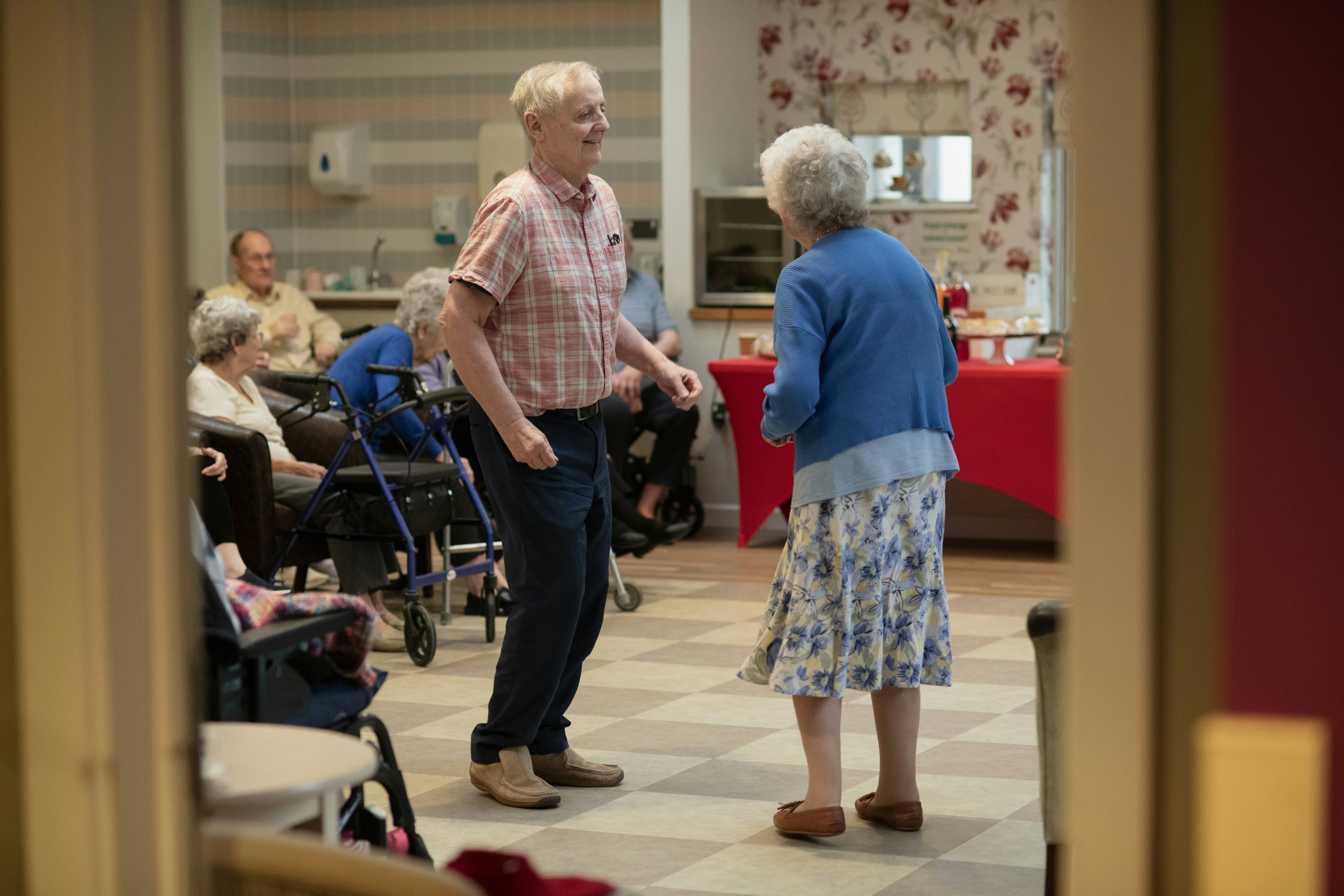

Sponge Cities and Nature-Based Flood Management

Qualified review required before publication: This draft is general education, not location-specific medical, public-health, legal, emergency, transport, building, electrical, environmental or engineering advice. Qualified local professionals, responsible authorities and safeguarding editors must review it before publication or implementation.
Rights, safety and privacy: Local law, hazards, standards and services vary. Protect personal information, obtain informed consent before sharing identifiable circumstances, and do not use this article as universal operational guidance. The example below is an illustrative composite and describes no real person, programme, partner or outcome.

Sponge Cities and Nature-Based Flood Management is ultimately a question about how a place works in daily life. A policy, building, route, park or digital system can look successful at city scale while excluding people in particular neighborhoods. A credible approach examines location, cost, reliability, safety, accessibility, environmental burden and influence over decisions—not merely whether an asset exists.

Sustainable Development Goal 11 connects safe and affordable housing, transport, participatory planning, heritage, disaster risk reduction and environmental impact. UN-Habitat, UNDRR, WHO urban-health resources, UNEP cities work and World Bank urban-development guidance provide complementary institutional perspectives. Global frameworks should be interpreted through current local evidence, law and professional standards.

“Sponge Cities and Nature-Based Flood Management succeeds when a city improves everyday access without transferring cost, risk or voice away from the people it serves.”

Why this matters for SDG 11

For this topic, a strong starting point is integrated land-use and service planning that treats access, safety, climate, culture and participation as connected urban outcomes. Sustainable urban development is not a collection of isolated projects. Land use changes travel demand; transport shapes access to work and care; housing location influences exposure and household cost; public space affects belonging; and infrastructure performance depends on maintenance, institutions and trust.

The question behind sponge cities and nature-based flood management should therefore be precise: which residents face which barrier, in what place, and which accountable institution can change it? The answer may involve immediate service improvement, long-term regulation, capital investment or community stewardship. Naming the level of action prevents a temporary activity from being presented as structural reform.

Equity matters because people do not experience a city from the same starting point. Income, age, gender, disability, language, tenure, work schedule and caring responsibilities influence whether an apparently available service is genuinely usable. Disaggregate evidence proportionately, protect privacy and combine it with voluntary resident insight so averages do not erase lived conditions.

What responsible local action requires

Work on sponge cities and nature-based flood management should begin by mapping the existing system: formal rules, informal practices, public responsibilities, market incentives, community assets and environmental constraints. Identify what can be changed within a year and what requires a longer statutory or infrastructure process. Keep the public record clear about trade-offs and uncertainty.

  • Map services and risk at neighborhood scale: name a responsible institution, provide resources and create an accessible route for feedback or remedy.
  • Bring residents into decisions before options are fixed: name a responsible institution, provide resources and create an accessible route for feedback or remedy.
  • Coordinate land use with transport and essential services: name a responsible institution, provide resources and create an accessible route for feedback or remedy.
  • Protect affordability and accessibility: name a responsible institution, provide resources and create an accessible route for feedback or remedy.
  • Fund maintenance and public accountability: name a responsible institution, provide resources and create an accessible route for feedback or remedy.

A practical city-action checklist

  • Define the concrete local outcome related to sponge cities and nature-based flood management, not only the broad ambition.
  • Map who can access the place or service, who bears risk and who is absent from the evidence.
  • Invite residents into decisions early and resource their participation.
  • Check accessibility, affordability, safety, privacy, culture and applicable local standards.
  • Choose output, outcome, distributional and unintended-effect indicators before launch.
  • Assign an owner, maintenance resources and an accessible complaint or appeal route.
  • Publish limitations, learning and corrective decisions alongside progress.

A realistic composite example

Imagine a fictional municipality examining sponge cities and nature-based flood management. It combines neighborhood-scale service and risk data with accessible workshops led by residents who face the greatest barriers. Relevant professionals review safety, legal, public-health and technical constraints. The city funds one bounded pilot, publishes who is accountable, and compares access, cost, reliability and complaints before considering expansion. Residents help interpret mixed results and decide what must change. This is an illustrative composite, not a verified case study.

The important feature is the sequence: define the local barrier, listen before selecting a solution, clarify responsibility, obtain qualified review where risk is involved, test a bounded change and compare outcomes across neighborhoods and groups. Replication should preserve principles but adapt the design to local law, climate, geography, culture and institutional capacity.

Common mistakes to avoid

Common mistakes include using citywide averages that hide neighborhood gaps, consulting residents after key decisions are already fixed, and funding visible construction without long-term operations. Teams also undermine credibility when they announce a model before establishing a baseline, count infrastructure without testing service quality, or celebrate total reach while ignoring people who cannot afford, enter, understand or safely use the intervention.

How to measure urban progress

Measurement should cover reach, quality, outcomes, distribution, safety and long-term value. Useful indicators for this topic include access to services by travel time and cost, affordability and displacement, resident influence over plans, and reliability, safety and environmental performance. Define the unit, geography, denominator, time period and relevant groups before interpreting a change.

Outputs describe activity: consultations held, homes improved, route-kilometers added, warnings sent, trees planted, waste collected or policies adopted. Outcomes ask whether people gained reliable access, faced lower risk, experienced greater affordability or had more influence. Compare actual performance with the counterfactual cautiously; do not claim causation from a simple before-and-after observation.

Use a baseline and targets where practical, but retain room to learn. Review evidence with residents and qualified specialists. Track maintenance, complaints, service interruptions, displacement, privacy incidents and environmental spillovers. Publish corrective decisions, not only favorable dashboard numbers, and explain when evidence is incomplete.

Authoritative resources and outbound links

These links are authoritative starting points, not a substitute for current local standards or professional judgment. Building, transport, public-health, water, disaster and emergency decisions require site-specific evidence and approval by qualified local authorities. Verify publication dates, applicability and legal status before using guidance operationally.

Conclusion: turn the idea into local progress

A practical next step on Sponge Cities and Nature-Based Flood Management is to identify one neighborhood-scale outcome that an accountable institution can improve. Invite people facing the barrier to define success, assign resources and responsibility, obtain the necessary review, and test a change small enough to correct. Make feedback and remedy available from the beginning.

SDG 11 becomes tangible when cities and communities can show who gained access, who remains excluded, what risks were reduced and what will change next. Progress on sponge cities and nature-based flood management should leave a place more affordable, safe, inclusive, resilient and accountable—and should give residents a stronger voice in its future.

Financing Sustainable Urban Infrastructure

Rights, safety and privacy: Local law, hazards, standards and services vary. Protect personal information, obtain informed consent before sharing identifiable circumstances, and do not use this article as universal operational guidance. The example below is an illustrative composite and describes no real person, programme, partner or outcome.

Financing Sustainable Urban Infrastructure is ultimately a question about how a place works in daily life. A policy, building, route, park or digital system can look successful at city scale while excluding people in particular neighborhoods. A credible approach examines location, cost, reliability, safety, accessibility, environmental burden and influence over decisions—not merely whether an asset exists.

Sustainable Development Goal 11 connects safe and affordable housing, transport, participatory planning, heritage, disaster risk reduction and environmental impact. UN-Habitat, UNDRR, WHO urban-health resources, UNEP cities work and World Bank urban-development guidance provide complementary institutional perspectives. Global frameworks should be interpreted through current local evidence, law and professional standards.

“Financing Sustainable Urban Infrastructure succeeds when a city improves everyday access without transferring cost, risk or voice away from the people it serves.”

Why this matters for SDG 11

For this topic, a strong starting point is integrated land-use and service planning that treats access, safety, climate, culture and participation as connected urban outcomes. Sustainable urban development is not a collection of isolated projects. Land use changes travel demand; transport shapes access to work and care; housing location influences exposure and household cost; public space affects belonging; and infrastructure performance depends on maintenance, institutions and trust.

The question behind financing sustainable urban infrastructure should therefore be precise: which residents face which barrier, in what place, and which accountable institution can change it? The answer may involve immediate service improvement, long-term regulation, capital investment or community stewardship. Naming the level of action prevents a temporary activity from being presented as structural reform.

Equity matters because people do not experience a city from the same starting point. Income, age, gender, disability, language, tenure, work schedule and caring responsibilities influence whether an apparently available service is genuinely usable. Disaggregate evidence proportionately, protect privacy and combine it with voluntary resident insight so averages do not erase lived conditions.

What responsible local action requires

Work on financing sustainable urban infrastructure should begin by mapping the existing system: formal rules, informal practices, public responsibilities, market incentives, community assets and environmental constraints. Identify what can be changed within a year and what requires a longer statutory or infrastructure process. Keep the public record clear about trade-offs and uncertainty.

  • Map services and risk at neighborhood scale: name a responsible institution, provide resources and create an accessible route for feedback or remedy.
  • Coordinate land use with transport and essential services: name a responsible institution, provide resources and create an accessible route for feedback or remedy.
  • Fund maintenance and public accountability: name a responsible institution, provide resources and create an accessible route for feedback or remedy.
  • Bring residents into decisions before options are fixed: name a responsible institution, provide resources and create an accessible route for feedback or remedy.
  • Protect affordability and accessibility: name a responsible institution, provide resources and create an accessible route for feedback or remedy.

A practical city-action checklist

  • Define the concrete local outcome related to financing sustainable urban infrastructure, not only the broad ambition.
  • Map who can access the place or service, who bears risk and who is absent from the evidence.
  • Invite residents into decisions early and resource their participation.
  • Check accessibility, affordability, safety, privacy, culture and applicable local standards.
  • Choose output, outcome, distributional and unintended-effect indicators before launch.
  • Assign an owner, maintenance resources and an accessible complaint or appeal route.
  • Publish limitations, learning and corrective decisions alongside progress.

A realistic composite example

Imagine a fictional municipality examining financing sustainable urban infrastructure. It combines neighborhood-scale service and risk data with accessible workshops led by residents who face the greatest barriers. Relevant professionals review safety, legal, public-health and technical constraints. The city funds one bounded pilot, publishes who is accountable, and compares access, cost, reliability and complaints before considering expansion. Residents help interpret mixed results and decide what must change. This is an illustrative composite, not a verified case study.

The important feature is the sequence: define the local barrier, listen before selecting a solution, clarify responsibility, obtain qualified review where risk is involved, test a bounded change and compare outcomes across neighborhoods and groups. Replication should preserve principles but adapt the design to local law, climate, geography, culture and institutional capacity.

Common mistakes to avoid

Common mistakes include using citywide averages that hide neighborhood gaps, consulting residents after key decisions are already fixed, and funding visible construction without long-term operations. Teams also undermine credibility when they announce a model before establishing a baseline, count infrastructure without testing service quality, or celebrate total reach while ignoring people who cannot afford, enter, understand or safely use the intervention.

How to measure urban progress

Measurement should cover reach, quality, outcomes, distribution, safety and long-term value. Useful indicators for this topic include resident influence over plans, affordability and displacement, access to services by travel time and cost, and reliability, safety and environmental performance. Define the unit, geography, denominator, time period and relevant groups before interpreting a change.

Outputs describe activity: consultations held, homes improved, route-kilometers added, warnings sent, trees planted, waste collected or policies adopted. Outcomes ask whether people gained reliable access, faced lower risk, experienced greater affordability or had more influence. Compare actual performance with the counterfactual cautiously; do not claim causation from a simple before-and-after observation.

Use a baseline and targets where practical, but retain room to learn. Review evidence with residents and qualified specialists. Track maintenance, complaints, service interruptions, displacement, privacy incidents and environmental spillovers. Publish corrective decisions, not only favorable dashboard numbers, and explain when evidence is incomplete.

Authoritative resources and outbound links

These links are authoritative starting points, not a substitute for current local standards or professional judgment. Building, transport, public-health, water, disaster and emergency decisions require site-specific evidence and approval by qualified local authorities. Verify publication dates, applicability and legal status before using guidance operationally.

Conclusion: turn the idea into local progress

A practical next step on Financing Sustainable Urban Infrastructure is to identify one neighborhood-scale outcome that an accountable institution can improve. Invite people facing the barrier to define success, assign resources and responsibility, obtain the necessary review, and test a change small enough to correct. Make feedback and remedy available from the beginning.

SDG 11 becomes tangible when cities and communities can show who gained access, who remains excluded, what risks were reduced and what will change next. Progress on financing sustainable urban infrastructure should leave a place more affordable, safe, inclusive, resilient and accountable—and should give residents a stronger voice in its future.

Creating Cities Where Everyone Can Belong

Rights, safety and privacy: Local law, hazards, standards and services vary. Protect personal information, obtain informed consent before sharing identifiable circumstances, and do not use this article as universal operational guidance. The example below is an illustrative composite and describes no real person, programme, partner or outcome.

Creating Cities Where Everyone Can Belong is ultimately a question about how a place works in daily life. A policy, building, route, park or digital system can look successful at city scale while excluding people in particular neighborhoods. A credible approach examines location, cost, reliability, safety, accessibility, environmental burden and influence over decisions—not merely whether an asset exists.

Sustainable Development Goal 11 connects safe and affordable housing, transport, participatory planning, heritage, disaster risk reduction and environmental impact. UN-Habitat, UNDRR, WHO urban-health resources, UNEP cities work and World Bank urban-development guidance provide complementary institutional perspectives. Global frameworks should be interpreted through current local evidence, law and professional standards.

“Creating Cities Where Everyone Can Belong succeeds when a city improves everyday access without transferring cost, risk or voice away from the people it serves.”

Why this matters for SDG 11

For this topic, a strong starting point is integrated land-use and service planning that treats access, safety, climate, culture and participation as connected urban outcomes. Sustainable urban development is not a collection of isolated projects. Land use changes travel demand; transport shapes access to work and care; housing location influences exposure and household cost; public space affects belonging; and infrastructure performance depends on maintenance, institutions and trust.

The question behind cities where everyone can belong should therefore be precise: which residents face which barrier, in what place, and which accountable institution can change it? The answer may involve immediate service improvement, long-term regulation, capital investment or community stewardship. Naming the level of action prevents a temporary activity from being presented as structural reform.

Equity matters because people do not experience a city from the same starting point. Income, age, gender, disability, language, tenure, work schedule and caring responsibilities influence whether an apparently available service is genuinely usable. Disaggregate evidence proportionately, protect privacy and combine it with voluntary resident insight so averages do not erase lived conditions.

What responsible local action requires

Work on cities where everyone can belong should begin by mapping the existing system: formal rules, informal practices, public responsibilities, market incentives, community assets and environmental constraints. Identify what can be changed within a year and what requires a longer statutory or infrastructure process. Keep the public record clear about trade-offs and uncertainty.

  • Fund maintenance and public accountability: name a responsible institution, provide resources and create an accessible route for feedback or remedy.
  • Coordinate land use with transport and essential services: name a responsible institution, provide resources and create an accessible route for feedback or remedy.
  • Map services and risk at neighborhood scale: name a responsible institution, provide resources and create an accessible route for feedback or remedy.
  • Protect affordability and accessibility: name a responsible institution, provide resources and create an accessible route for feedback or remedy.
  • Bring residents into decisions before options are fixed: name a responsible institution, provide resources and create an accessible route for feedback or remedy.

A practical city-action checklist

  • Define the concrete local outcome related to cities where everyone can belong, not only the broad ambition.
  • Map who can access the place or service, who bears risk and who is absent from the evidence.
  • Invite residents into decisions early and resource their participation.
  • Check accessibility, affordability, safety, privacy, culture and applicable local standards.
  • Choose output, outcome, distributional and unintended-effect indicators before launch.
  • Assign an owner, maintenance resources and an accessible complaint or appeal route.
  • Publish limitations, learning and corrective decisions alongside progress.

A realistic composite example

Imagine a fictional municipality examining cities where everyone can belong. It combines neighborhood-scale service and risk data with accessible workshops led by residents who face the greatest barriers. Relevant professionals review safety, legal, public-health and technical constraints. The city funds one bounded pilot, publishes who is accountable, and compares access, cost, reliability and complaints before considering expansion. Residents help interpret mixed results and decide what must change. This is an illustrative composite, not a verified case study.

The important feature is the sequence: define the local barrier, listen before selecting a solution, clarify responsibility, obtain qualified review where risk is involved, test a bounded change and compare outcomes across neighborhoods and groups. Replication should preserve principles but adapt the design to local law, climate, geography, culture and institutional capacity.

Common mistakes to avoid

Common mistakes include consulting residents after key decisions are already fixed, funding visible construction without long-term operations, and using citywide averages that hide neighborhood gaps. Teams also undermine credibility when they announce a model before establishing a baseline, count infrastructure without testing service quality, or celebrate total reach while ignoring people who cannot afford, enter, understand or safely use the intervention.

How to measure urban progress

Measurement should cover reach, quality, outcomes, distribution, safety and long-term value. Useful indicators for this topic include resident influence over plans, access to services by travel time and cost, affordability and displacement, and reliability, safety and environmental performance. Define the unit, geography, denominator, time period and relevant groups before interpreting a change.

Outputs describe activity: consultations held, homes improved, route-kilometers added, warnings sent, trees planted, waste collected or policies adopted. Outcomes ask whether people gained reliable access, faced lower risk, experienced greater affordability or had more influence. Compare actual performance with the counterfactual cautiously; do not claim causation from a simple before-and-after observation.

Use a baseline and targets where practical, but retain room to learn. Review evidence with residents and qualified specialists. Track maintenance, complaints, service interruptions, displacement, privacy incidents and environmental spillovers. Publish corrective decisions, not only favorable dashboard numbers, and explain when evidence is incomplete.

Authoritative resources and outbound links

These links are authoritative starting points, not a substitute for current local standards or professional judgment. Building, transport, public-health, water, disaster and emergency decisions require site-specific evidence and approval by qualified local authorities. Verify publication dates, applicability and legal status before using guidance operationally.

Conclusion: turn the idea into local progress

A practical next step on Creating Cities Where Everyone Can Belong is to identify one neighborhood-scale outcome that an accountable institution can improve. Invite people facing the barrier to define success, assign resources and responsibility, obtain the necessary review, and test a change small enough to correct. Make feedback and remedy available from the beginning.

SDG 11 becomes tangible when cities and communities can show who gained access, who remains excluded, what risks were reduced and what will change next. Progress on cities where everyone can belong should leave a place more affordable, safe, inclusive, resilient and accountable—and should give residents a stronger voice in its future.

Why Every Neighborhood Needs Access to Nature

Rights, safety and privacy: Local law, hazards, standards and services vary. Protect personal information, obtain informed consent before sharing identifiable circumstances, and do not use this article as universal operational guidance. The example below is an illustrative composite and describes no real person, programme, partner or outcome.

Why Every Neighborhood Needs Access to Nature is ultimately a question about how a place works in daily life. A policy, building, route, park or digital system can look successful at city scale while excluding people in particular neighborhoods. A credible approach examines location, cost, reliability, safety, accessibility, environmental burden and influence over decisions—not merely whether an asset exists.

Sustainable Development Goal 11 connects safe and affordable housing, transport, participatory planning, heritage, disaster risk reduction and environmental impact. UN-Habitat, UNDRR, WHO urban-health resources, UNEP cities work and World Bank urban-development guidance provide complementary institutional perspectives. Global frameworks should be interpreted through current local evidence, law and professional standards.

“Why Every Neighborhood Needs Access to Nature succeeds when a city improves everyday access without transferring cost, risk or voice away from the people it serves.”

Connecting the issue to sustainable communities

For this topic, a strong starting point is integrated land-use and service planning that treats access, safety, climate, culture and participation as connected urban outcomes. Sustainable urban development is not a collection of isolated projects. Land use changes travel demand; transport shapes access to work and care; housing location influences exposure and household cost; public space affects belonging; and infrastructure performance depends on maintenance, institutions and trust.

The question behind every neighborhood needs access to nature should therefore be precise: which residents face which barrier, in what place, and which accountable institution can change it? The answer may involve immediate service improvement, long-term regulation, capital investment or community stewardship. Naming the level of action prevents a temporary activity from being presented as structural reform.

Equity matters because people do not experience a city from the same starting point. Income, age, gender, disability, language, tenure, work schedule and caring responsibilities influence whether an apparently available service is genuinely usable. Disaggregate evidence proportionately, protect privacy and combine it with voluntary resident insight so averages do not erase lived conditions.

Designing with access, safety and resident voice

Work on every neighborhood needs access to nature should begin by mapping the existing system: formal rules, informal practices, public responsibilities, market incentives, community assets and environmental constraints. Identify what can be changed within a year and what requires a longer statutory or infrastructure process. Keep the public record clear about trade-offs and uncertainty.

  • Map services and risk at neighborhood scale: name a responsible institution, provide resources and create an accessible route for feedback or remedy.
  • Protect affordability and accessibility: name a responsible institution, provide resources and create an accessible route for feedback or remedy.
  • Coordinate land use with transport and essential services: name a responsible institution, provide resources and create an accessible route for feedback or remedy.
  • Fund maintenance and public accountability: name a responsible institution, provide resources and create an accessible route for feedback or remedy.
  • Bring residents into decisions before options are fixed: name a responsible institution, provide resources and create an accessible route for feedback or remedy.

Checklist for responsible implementation

  • Define the concrete local outcome related to every neighborhood needs access to nature, not only the broad ambition.
  • Map who can access the place or service, who bears risk and who is absent from the evidence.
  • Invite residents into decisions early and resource their participation.
  • Check accessibility, affordability, safety, privacy, culture and applicable local standards.
  • Choose output, outcome, distributional and unintended-effect indicators before launch.
  • Assign an owner, maintenance resources and an accessible complaint or appeal route.
  • Publish limitations, learning and corrective decisions alongside progress.

How this could work in practice

Consider a non-identifiable community coalition working on every neighborhood needs access to nature. Before advocating a specific design, it maps travel time, price, physical access, environmental burden and displacement risk. Public agencies clarify their duties, community groups contribute local knowledge, and qualified specialists test assumptions. A small intervention includes maintenance funding and a feedback route. Evidence is reviewed by neighborhood rather than only citywide. No actual person, organization, partner or result is implied.

The important feature is the sequence: define the local barrier, listen before selecting a solution, clarify responsibility, obtain qualified review where risk is involved, test a bounded change and compare outcomes across neighborhoods and groups. Replication should preserve principles but adapt the design to local law, climate, geography, culture and institutional capacity.

Pitfalls that weaken urban outcomes

Common mistakes include funding visible construction without long-term operations, consulting residents after key decisions are already fixed, and using citywide averages that hide neighborhood gaps. Teams also undermine credibility when they announce a model before establishing a baseline, count infrastructure without testing service quality, or celebrate total reach while ignoring people who cannot afford, enter, understand or safely use the intervention.

Measurement, learning and accountability

Measurement should cover reach, quality, outcomes, distribution, safety and long-term value. Useful indicators for this topic include reliability, safety and environmental performance, affordability and displacement, access to services by travel time and cost, and resident influence over plans. Define the unit, geography, denominator, time period and relevant groups before interpreting a change.

Outputs describe activity: consultations held, homes improved, route-kilometers added, warnings sent, trees planted, waste collected or policies adopted. Outcomes ask whether people gained reliable access, faced lower risk, experienced greater affordability or had more influence. Compare actual performance with the counterfactual cautiously; do not claim causation from a simple before-and-after observation.

Use a baseline and targets where practical, but retain room to learn. Review evidence with residents and qualified specialists. Track maintenance, complaints, service interruptions, displacement, privacy incidents and environmental spillovers. Publish corrective decisions, not only favorable dashboard numbers, and explain when evidence is incomplete.

Trusted sources for further learning

These links are authoritative starting points, not a substitute for current local standards or professional judgment. Building, transport, public-health, water, disaster and emergency decisions require site-specific evidence and approval by qualified local authorities. Verify publication dates, applicability and legal status before using guidance operationally.

A practical way forward

A practical next step on Why Every Neighborhood Needs Access to Nature is to identify one neighborhood-scale outcome that an accountable institution can improve. Invite people facing the barrier to define success, assign resources and responsibility, obtain the necessary review, and test a change small enough to correct. Make feedback and remedy available from the beginning.

SDG 11 becomes tangible when cities and communities can show who gained access, who remains excluded, what risks were reduced and what will change next. Progress on every neighborhood needs access to nature should leave a place more affordable, safe, inclusive, resilient and accountable—and should give residents a stronger voice in its future.

Designing Safe Streets for Children and Pedestrians

Qualified review required before publication: This draft is general education, not location-specific medical, public-health, legal, emergency, transport, building, electrical, environmental or engineering advice. Qualified local professionals, responsible authorities and safeguarding editors must review it before publication or implementation.
Rights, safety and privacy: Local law, hazards, standards and services vary. Protect personal information, obtain informed consent before sharing identifiable circumstances, and do not use this article as universal operational guidance. The example below is an illustrative composite and describes no real person, programme, partner or outcome.

Designing Safe Streets for Children and Pedestrians is ultimately a question about how a place works in daily life. A policy, building, route, park or digital system can look successful at city scale while excluding people in particular neighborhoods. A credible approach examines location, cost, reliability, safety, accessibility, environmental burden and influence over decisions—not merely whether an asset exists.

Sustainable Development Goal 11 connects safe and affordable housing, transport, participatory planning, heritage, disaster risk reduction and environmental impact. UN-Habitat, UNDRR, WHO urban-health resources, UNEP cities work and World Bank urban-development guidance provide complementary institutional perspectives. Global frameworks should be interpreted through current local evidence, law and professional standards.

“Designing Safe Streets for Children and Pedestrians succeeds when a city improves everyday access without transferring cost, risk or voice away from the people it serves.”

Connecting the issue to sustainable communities

For this topic, a strong starting point is safe, affordable and accessible mobility that connects people to jobs, education, care and public life while reducing environmental harm. Sustainable urban development is not a collection of isolated projects. Land use changes travel demand; transport shapes access to work and care; housing location influences exposure and household cost; public space affects belonging; and infrastructure performance depends on maintenance, institutions and trust.

The question behind safe streets for children and pedestrians should therefore be precise: which residents face which barrier, in what place, and which accountable institution can change it? The answer may involve immediate service improvement, long-term regulation, capital investment or community stewardship. Naming the level of action prevents a temporary activity from being presented as structural reform.

Equity matters because people do not experience a city from the same starting point. Income, age, gender, disability, language, tenure, work schedule and caring responsibilities influence whether an apparently available service is genuinely usable. Disaggregate evidence proportionately, protect privacy and combine it with voluntary resident insight so averages do not erase lived conditions.

Designing with access, safety and resident voice

Work on safe streets for children and pedestrians should begin by mapping the existing system: formal rules, informal practices, public responsibilities, market incentives, community assets and environmental constraints. Identify what can be changed within a year and what requires a longer statutory or infrastructure process. Keep the public record clear about trade-offs and uncertainty.

  • Design with women, children, older adults and persons with disabilities: name a responsible institution, provide resources and create an accessible route for feedback or remedy.
  • Use qualified local safety and engineering review: name a responsible institution, provide resources and create an accessible route for feedback or remedy.
  • Prioritize safe walking, cycling and public transport: name a responsible institution, provide resources and create an accessible route for feedback or remedy.
  • Measure door-to-door access rather than route coverage: name a responsible institution, provide resources and create an accessible route for feedback or remedy.
  • Integrate fares, schedules and land use: name a responsible institution, provide resources and create an accessible route for feedback or remedy.

Checklist for responsible implementation

  • Define the concrete local outcome related to safe streets for children and pedestrians, not only the broad ambition.
  • Map who can access the place or service, who bears risk and who is absent from the evidence.
  • Invite residents into decisions early and resource their participation.
  • Check accessibility, affordability, safety, privacy, culture and applicable local standards.
  • Choose output, outcome, distributional and unintended-effect indicators before launch.
  • Assign an owner, maintenance resources and an accessible complaint or appeal route.
  • Publish limitations, learning and corrective decisions alongside progress.

How this could work in practice

Consider a non-identifiable community coalition working on safe streets for children and pedestrians. Before advocating a specific design, it maps travel time, price, physical access, environmental burden and displacement risk. Public agencies clarify their duties, community groups contribute local knowledge, and qualified specialists test assumptions. A small intervention includes maintenance funding and a feedback route. Evidence is reviewed by neighborhood rather than only citywide. No actual person, organization, partner or result is implied.

The important feature is the sequence: define the local barrier, listen before selecting a solution, clarify responsibility, obtain qualified review where risk is involved, test a bounded change and compare outcomes across neighborhoods and groups. Replication should preserve principles but adapt the design to local law, climate, geography, culture and institutional capacity.

Pitfalls that weaken urban outcomes

Common mistakes include removing car access before reliable alternatives exist, assuming infrastructure automatically changes travel behavior, and improving speed while weakening pedestrian safety. Teams also undermine credibility when they announce a model before establishing a baseline, count infrastructure without testing service quality, or celebrate total reach while ignoring people who cannot afford, enter, understand or safely use the intervention.

Measurement, learning and accountability

Measurement should cover reach, quality, outcomes, distribution, safety and long-term value. Useful indicators for this topic include injuries and perceived safety, accessibility and service reliability, door-to-door travel time and affordability, and mode share, emissions and access to opportunity. Define the unit, geography, denominator, time period and relevant groups before interpreting a change.

Outputs describe activity: consultations held, homes improved, route-kilometers added, warnings sent, trees planted, waste collected or policies adopted. Outcomes ask whether people gained reliable access, faced lower risk, experienced greater affordability or had more influence. Compare actual performance with the counterfactual cautiously; do not claim causation from a simple before-and-after observation.

Use a baseline and targets where practical, but retain room to learn. Review evidence with residents and qualified specialists. Track maintenance, complaints, service interruptions, displacement, privacy incidents and environmental spillovers. Publish corrective decisions, not only favorable dashboard numbers, and explain when evidence is incomplete.

Trusted sources for further learning

These links are authoritative starting points, not a substitute for current local standards or professional judgment. Building, transport, public-health, water, disaster and emergency decisions require site-specific evidence and approval by qualified local authorities. Verify publication dates, applicability and legal status before using guidance operationally.

A practical way forward

A practical next step on Designing Safe Streets for Children and Pedestrians is to identify one neighborhood-scale outcome that an accountable institution can improve. Invite people facing the barrier to define success, assign resources and responsibility, obtain the necessary review, and test a change small enough to correct. Make feedback and remedy available from the beginning.

SDG 11 becomes tangible when cities and communities can show who gained access, who remains excluded, what risks were reduced and what will change next. Progress on safe streets for children and pedestrians should leave a place more affordable, safe, inclusive, resilient and accountable—and should give residents a stronger voice in its future.

Modernizing Aging Water Infrastructure

Qualified review required before publication: This draft is general education, not location-specific medical, public-health, legal, emergency, transport, building, electrical, environmental or engineering advice. Qualified local professionals, responsible authorities and safeguarding editors must review it before publication or implementation.
Rights, safety and privacy: Local law, hazards, standards and services vary. Protect personal information, obtain informed consent before sharing identifiable circumstances, and do not use this article as universal operational guidance. The example below is an illustrative composite and describes no real person, programme, partner or outcome.

Modernizing Aging Water Infrastructure is ultimately a question about how a place works in daily life. A policy, building, route, park or digital system can look successful at city scale while excluding people in particular neighborhoods. A credible approach examines location, cost, reliability, safety, accessibility, environmental burden and influence over decisions—not merely whether an asset exists.

Sustainable Development Goal 11 connects safe and affordable housing, transport, participatory planning, heritage, disaster risk reduction and environmental impact. UN-Habitat, UNDRR, WHO urban-health resources, UNEP cities work and World Bank urban-development guidance provide complementary institutional perspectives. Global frameworks should be interpreted through current local evidence, law and professional standards.

“Modernizing Aging Water Infrastructure succeeds when a city improves everyday access without transferring cost, risk or voice away from the people it serves.”

The systems behind this urban challenge

For this topic, a strong starting point is safe and inclusive urban resource systems that prevent pollution, protect workers and deliver reliable water, sanitation and waste services. Sustainable urban development is not a collection of isolated projects. Land use changes travel demand; transport shapes access to work and care; housing location influences exposure and household cost; public space affects belonging; and infrastructure performance depends on maintenance, institutions and trust.

The question behind aging water infrastructure should therefore be precise: which residents face which barrier, in what place, and which accountable institution can change it? The answer may involve immediate service improvement, long-term regulation, capital investment or community stewardship. Naming the level of action prevents a temporary activity from being presented as structural reform.

Equity matters because people do not experience a city from the same starting point. Income, age, gender, disability, language, tenure, work schedule and caring responsibilities influence whether an apparently available service is genuinely usable. Disaggregate evidence proportionately, protect privacy and combine it with voluntary resident insight so averages do not erase lived conditions.

From consultation to accountable delivery

Work on aging water infrastructure should begin by mapping the existing system: formal rules, informal practices, public responsibilities, market incentives, community assets and environmental constraints. Identify what can be changed within a year and what requires a longer statutory or infrastructure process. Keep the public record clear about trade-offs and uncertainty.

  • Recognize and protect informal workers: name a responsible institution, provide resources and create an accessible route for feedback or remedy.
  • Map service gaps and material flows: name a responsible institution, provide resources and create an accessible route for feedback or remedy.
  • Use qualified public-health and engineering review: name a responsible institution, provide resources and create an accessible route for feedback or remedy.
  • Prioritize prevention and reliable collection: name a responsible institution, provide resources and create an accessible route for feedback or remedy.
  • Connect capital investment with maintenance and accountability: name a responsible institution, provide resources and create an accessible route for feedback or remedy.

A readiness checklist

  • Define the concrete local outcome related to aging water infrastructure, not only the broad ambition.
  • Map who can access the place or service, who bears risk and who is absent from the evidence.
  • Invite residents into decisions early and resource their participation.
  • Check accessibility, affordability, safety, privacy, culture and applicable local standards.
  • Choose output, outcome, distributional and unintended-effect indicators before launch.
  • Assign an owner, maintenance resources and an accessible complaint or appeal route.
  • Publish limitations, learning and corrective decisions alongside progress.

A hypothetical neighborhood example

Picture a fictional district planning process focused on aging water infrastructure. Residents, frontline workers and technical staff agree on a shared problem statement, but they do not assume one solution. They compare options against affordability, safety, climate, accessibility and cultural continuity. The chosen pilot has a named owner, maintenance budget and stop criteria. Findings—including shortcomings—are made public. This composite reports no real beneficiary or programme.

The important feature is the sequence: define the local barrier, listen before selecting a solution, clarify responsibility, obtain qualified review where risk is involved, test a bounded change and compare outcomes across neighborhoods and groups. Replication should preserve principles but adapt the design to local law, climate, geography, culture and institutional capacity.

Mistakes that create new barriers

Common mistakes include publishing unverified treatment or handling instructions, excluding informal workers from formal reforms, and building facilities without viable operations. Teams also undermine credibility when they announce a model before establishing a baseline, count infrastructure without testing service quality, or celebrate total reach while ignoring people who cannot afford, enter, understand or safely use the intervention.

Indicators that support better decisions

Measurement should cover reach, quality, outcomes, distribution, safety and long-term value. Useful indicators for this topic include service coverage, affordability and reliability, pollution and material recovery, worker safety and livelihood outcomes, and complaints, downtime and neighborhood disparities. Define the unit, geography, denominator, time period and relevant groups before interpreting a change.

Outputs describe activity: consultations held, homes improved, route-kilometers added, warnings sent, trees planted, waste collected or policies adopted. Outcomes ask whether people gained reliable access, faced lower risk, experienced greater affordability or had more influence. Compare actual performance with the counterfactual cautiously; do not claim causation from a simple before-and-after observation.

Use a baseline and targets where practical, but retain room to learn. Review evidence with residents and qualified specialists. Track maintenance, complaints, service interruptions, displacement, privacy incidents and environmental spillovers. Publish corrective decisions, not only favorable dashboard numbers, and explain when evidence is incomplete.

Institutional sources and guidance

These links are authoritative starting points, not a substitute for current local standards or professional judgment. Building, transport, public-health, water, disaster and emergency decisions require site-specific evidence and approval by qualified local authorities. Verify publication dates, applicability and legal status before using guidance operationally.

Next steps for communities and city leaders

A practical next step on Modernizing Aging Water Infrastructure is to identify one neighborhood-scale outcome that an accountable institution can improve. Invite people facing the barrier to define success, assign resources and responsibility, obtain the necessary review, and test a change small enough to correct. Make feedback and remedy available from the beginning.

SDG 11 becomes tangible when cities and communities can show who gained access, who remains excluded, what risks were reduced and what will change next. Progress on aging water infrastructure should leave a place more affordable, safe, inclusive, resilient and accountable—and should give residents a stronger voice in its future.

Creating Walkable Cities for Health and Sustainability

Qualified review required before publication: This draft is general education, not location-specific medical, public-health, legal, emergency, transport, building, electrical, environmental or engineering advice. Qualified local professionals, responsible authorities and safeguarding editors must review it before publication or implementation.
Rights, safety and privacy: Local law, hazards, standards and services vary. Protect personal information, obtain informed consent before sharing identifiable circumstances, and do not use this article as universal operational guidance. The example below is an illustrative composite and describes no real person, programme, partner or outcome.

Creating Walkable Cities for Health and Sustainability is ultimately a question about how a place works in daily life. A policy, building, route, park or digital system can look successful at city scale while excluding people in particular neighborhoods. A credible approach examines location, cost, reliability, safety, accessibility, environmental burden and influence over decisions—not merely whether an asset exists.

Sustainable Development Goal 11 connects safe and affordable housing, transport, participatory planning, heritage, disaster risk reduction and environmental impact. UN-Habitat, UNDRR, WHO urban-health resources, UNEP cities work and World Bank urban-development guidance provide complementary institutional perspectives. Global frameworks should be interpreted through current local evidence, law and professional standards.

“Creating Walkable Cities for Health and Sustainability succeeds when a city improves everyday access without transferring cost, risk or voice away from the people it serves.”

The systems behind this urban challenge

For this topic, a strong starting point is integrated land-use and service planning that treats access, safety, climate, culture and participation as connected urban outcomes. Sustainable urban development is not a collection of isolated projects. Land use changes travel demand; transport shapes access to work and care; housing location influences exposure and household cost; public space affects belonging; and infrastructure performance depends on maintenance, institutions and trust.

The question behind walkable cities for health and sustainability should therefore be precise: which residents face which barrier, in what place, and which accountable institution can change it? The answer may involve immediate service improvement, long-term regulation, capital investment or community stewardship. Naming the level of action prevents a temporary activity from being presented as structural reform.

Equity matters because people do not experience a city from the same starting point. Income, age, gender, disability, language, tenure, work schedule and caring responsibilities influence whether an apparently available service is genuinely usable. Disaggregate evidence proportionately, protect privacy and combine it with voluntary resident insight so averages do not erase lived conditions.

From consultation to accountable delivery

Work on walkable cities for health and sustainability should begin by mapping the existing system: formal rules, informal practices, public responsibilities, market incentives, community assets and environmental constraints. Identify what can be changed within a year and what requires a longer statutory or infrastructure process. Keep the public record clear about trade-offs and uncertainty.

  • Protect affordability and accessibility: name a responsible institution, provide resources and create an accessible route for feedback or remedy.
  • Bring residents into decisions before options are fixed: name a responsible institution, provide resources and create an accessible route for feedback or remedy.
  • Coordinate land use with transport and essential services: name a responsible institution, provide resources and create an accessible route for feedback or remedy.
  • Fund maintenance and public accountability: name a responsible institution, provide resources and create an accessible route for feedback or remedy.
  • Map services and risk at neighborhood scale: name a responsible institution, provide resources and create an accessible route for feedback or remedy.

A readiness checklist

  • Define the concrete local outcome related to walkable cities for health and sustainability, not only the broad ambition.
  • Map who can access the place or service, who bears risk and who is absent from the evidence.
  • Invite residents into decisions early and resource their participation.
  • Check accessibility, affordability, safety, privacy, culture and applicable local standards.
  • Choose output, outcome, distributional and unintended-effect indicators before launch.
  • Assign an owner, maintenance resources and an accessible complaint or appeal route.
  • Publish limitations, learning and corrective decisions alongside progress.

A hypothetical neighborhood example

Picture a fictional district planning process focused on walkable cities for health and sustainability. Residents, frontline workers and technical staff agree on a shared problem statement, but they do not assume one solution. They compare options against affordability, safety, climate, accessibility and cultural continuity. The chosen pilot has a named owner, maintenance budget and stop criteria. Findings—including shortcomings—are made public. This composite reports no real beneficiary or programme.

The important feature is the sequence: define the local barrier, listen before selecting a solution, clarify responsibility, obtain qualified review where risk is involved, test a bounded change and compare outcomes across neighborhoods and groups. Replication should preserve principles but adapt the design to local law, climate, geography, culture and institutional capacity.

Mistakes that create new barriers

Common mistakes include funding visible construction without long-term operations, consulting residents after key decisions are already fixed, and using citywide averages that hide neighborhood gaps. Teams also undermine credibility when they announce a model before establishing a baseline, count infrastructure without testing service quality, or celebrate total reach while ignoring people who cannot afford, enter, understand or safely use the intervention.

Indicators that support better decisions

Measurement should cover reach, quality, outcomes, distribution, safety and long-term value. Useful indicators for this topic include resident influence over plans, affordability and displacement, reliability, safety and environmental performance, and access to services by travel time and cost. Define the unit, geography, denominator, time period and relevant groups before interpreting a change.

Outputs describe activity: consultations held, homes improved, route-kilometers added, warnings sent, trees planted, waste collected or policies adopted. Outcomes ask whether people gained reliable access, faced lower risk, experienced greater affordability or had more influence. Compare actual performance with the counterfactual cautiously; do not claim causation from a simple before-and-after observation.

Use a baseline and targets where practical, but retain room to learn. Review evidence with residents and qualified specialists. Track maintenance, complaints, service interruptions, displacement, privacy incidents and environmental spillovers. Publish corrective decisions, not only favorable dashboard numbers, and explain when evidence is incomplete.

Institutional sources and guidance

These links are authoritative starting points, not a substitute for current local standards or professional judgment. Building, transport, public-health, water, disaster and emergency decisions require site-specific evidence and approval by qualified local authorities. Verify publication dates, applicability and legal status before using guidance operationally.

Next steps for communities and city leaders

A practical next step on Creating Walkable Cities for Health and Sustainability is to identify one neighborhood-scale outcome that an accountable institution can improve. Invite people facing the barrier to define success, assign resources and responsibility, obtain the necessary review, and test a change small enough to correct. Make feedback and remedy available from the beginning.

SDG 11 becomes tangible when cities and communities can show who gained access, who remains excluded, what risks were reduced and what will change next. Progress on walkable cities for health and sustainability should leave a place more affordable, safe, inclusive, resilient and accountable—and should give residents a stronger voice in its future.

Making Public Transportation Safe for Women

Qualified review required before publication: This draft is general education, not location-specific medical, public-health, legal, emergency, transport, building, electrical, environmental or engineering advice. Qualified local professionals, responsible authorities and safeguarding editors must review it before publication or implementation.
Rights, safety and privacy: Local law, hazards, standards and services vary. Protect personal information, obtain informed consent before sharing identifiable circumstances, and do not use this article as universal operational guidance. The example below is an illustrative composite and describes no real person, programme, partner or outcome.

Making Public Transportation Safe for Women is ultimately a question about how a place works in daily life. A policy, building, route, park or digital system can look successful at city scale while excluding people in particular neighborhoods. A credible approach examines location, cost, reliability, safety, accessibility, environmental burden and influence over decisions—not merely whether an asset exists.

Sustainable Development Goal 11 connects safe and affordable housing, transport, participatory planning, heritage, disaster risk reduction and environmental impact. UN-Habitat, UNDRR, WHO urban-health resources, UNEP cities work and World Bank urban-development guidance provide complementary institutional perspectives. Global frameworks should be interpreted through current local evidence, law and professional standards.

“Making Public Transportation Safe for Women succeeds when a city improves everyday access without transferring cost, risk or voice away from the people it serves.”

Why this matters for SDG 11

For this topic, a strong starting point is safe, affordable and accessible mobility that connects people to jobs, education, care and public life while reducing environmental harm. Sustainable urban development is not a collection of isolated projects. Land use changes travel demand; transport shapes access to work and care; housing location influences exposure and household cost; public space affects belonging; and infrastructure performance depends on maintenance, institutions and trust.

The question behind public transportation safe for women should therefore be precise: which residents face which barrier, in what place, and which accountable institution can change it? The answer may involve immediate service improvement, long-term regulation, capital investment or community stewardship. Naming the level of action prevents a temporary activity from being presented as structural reform.

Equity matters because people do not experience a city from the same starting point. Income, age, gender, disability, language, tenure, work schedule and caring responsibilities influence whether an apparently available service is genuinely usable. Disaggregate evidence proportionately, protect privacy and combine it with voluntary resident insight so averages do not erase lived conditions.

What responsible local action requires

Work on public transportation safe for women should begin by mapping the existing system: formal rules, informal practices, public responsibilities, market incentives, community assets and environmental constraints. Identify what can be changed within a year and what requires a longer statutory or infrastructure process. Keep the public record clear about trade-offs and uncertainty.

  • Use qualified local safety and engineering review: name a responsible institution, provide resources and create an accessible route for feedback or remedy.
  • Measure door-to-door access rather than route coverage: name a responsible institution, provide resources and create an accessible route for feedback or remedy.
  • Prioritize safe walking, cycling and public transport: name a responsible institution, provide resources and create an accessible route for feedback or remedy.
  • Integrate fares, schedules and land use: name a responsible institution, provide resources and create an accessible route for feedback or remedy.
  • Design with women, children, older adults and persons with disabilities: name a responsible institution, provide resources and create an accessible route for feedback or remedy.

A practical city-action checklist

  • Define the concrete local outcome related to public transportation safe for women, not only the broad ambition.
  • Map who can access the place or service, who bears risk and who is absent from the evidence.
  • Invite residents into decisions early and resource their participation.
  • Check accessibility, affordability, safety, privacy, culture and applicable local standards.
  • Choose output, outcome, distributional and unintended-effect indicators before launch.
  • Assign an owner, maintenance resources and an accessible complaint or appeal route.
  • Publish limitations, learning and corrective decisions alongside progress.

A realistic composite example

Imagine a fictional municipality examining public transportation safe for women. It combines neighborhood-scale service and risk data with accessible workshops led by residents who face the greatest barriers. Relevant professionals review safety, legal, public-health and technical constraints. The city funds one bounded pilot, publishes who is accountable, and compares access, cost, reliability and complaints before considering expansion. Residents help interpret mixed results and decide what must change. This is an illustrative composite, not a verified case study.

The important feature is the sequence: define the local barrier, listen before selecting a solution, clarify responsibility, obtain qualified review where risk is involved, test a bounded change and compare outcomes across neighborhoods and groups. Replication should preserve principles but adapt the design to local law, climate, geography, culture and institutional capacity.

Common mistakes to avoid

Common mistakes include improving speed while weakening pedestrian safety, removing car access before reliable alternatives exist, and assuming infrastructure automatically changes travel behavior. Teams also undermine credibility when they announce a model before establishing a baseline, count infrastructure without testing service quality, or celebrate total reach while ignoring people who cannot afford, enter, understand or safely use the intervention.

How to measure urban progress

Measurement should cover reach, quality, outcomes, distribution, safety and long-term value. Useful indicators for this topic include door-to-door travel time and affordability, injuries and perceived safety, accessibility and service reliability, and mode share, emissions and access to opportunity. Define the unit, geography, denominator, time period and relevant groups before interpreting a change.

Outputs describe activity: consultations held, homes improved, route-kilometers added, warnings sent, trees planted, waste collected or policies adopted. Outcomes ask whether people gained reliable access, faced lower risk, experienced greater affordability or had more influence. Compare actual performance with the counterfactual cautiously; do not claim causation from a simple before-and-after observation.

Use a baseline and targets where practical, but retain room to learn. Review evidence with residents and qualified specialists. Track maintenance, complaints, service interruptions, displacement, privacy incidents and environmental spillovers. Publish corrective decisions, not only favorable dashboard numbers, and explain when evidence is incomplete.

Authoritative resources and outbound links

These links are authoritative starting points, not a substitute for current local standards or professional judgment. Building, transport, public-health, water, disaster and emergency decisions require site-specific evidence and approval by qualified local authorities. Verify publication dates, applicability and legal status before using guidance operationally.

Conclusion: turn the idea into local progress

A practical next step on Making Public Transportation Safe for Women is to identify one neighborhood-scale outcome that an accountable institution can improve. Invite people facing the barrier to define success, assign resources and responsibility, obtain the necessary review, and test a change small enough to correct. Make feedback and remedy available from the beginning.

SDG 11 becomes tangible when cities and communities can show who gained access, who remains excluded, what risks were reduced and what will change next. Progress on public transportation safe for women should leave a place more affordable, safe, inclusive, resilient and accountable—and should give residents a stronger voice in its future.

Why Sustainable Cities Are Essential to Our Future

Rights, safety and privacy: Local law, hazards, standards and services vary. Protect personal information, obtain informed consent before sharing identifiable circumstances, and do not use this article as universal operational guidance. The example below is an illustrative composite and describes no real person, programme, partner or outcome.

Why Sustainable Cities Are Essential to Our Future is ultimately a question about how a place works in daily life. A policy, building, route, park or digital system can look successful at city scale while excluding people in particular neighborhoods. A credible approach examines location, cost, reliability, safety, accessibility, environmental burden and influence over decisions—not merely whether an asset exists.

Sustainable Development Goal 11 connects safe and affordable housing, transport, participatory planning, heritage, disaster risk reduction and environmental impact. UN-Habitat, UNDRR, WHO urban-health resources, UNEP cities work and World Bank urban-development guidance provide complementary institutional perspectives. Global frameworks should be interpreted through current local evidence, law and professional standards.

“Why Sustainable Cities Are Essential to Our Future succeeds when a city improves everyday access without transferring cost, risk or voice away from the people it serves.”

Connecting the issue to sustainable communities

For this topic, a strong starting point is integrated land-use and service planning that treats access, safety, climate, culture and participation as connected urban outcomes. Sustainable urban development is not a collection of isolated projects. Land use changes travel demand; transport shapes access to work and care; housing location influences exposure and household cost; public space affects belonging; and infrastructure performance depends on maintenance, institutions and trust.

The question behind sustainable cities are essential to our future should therefore be precise: which residents face which barrier, in what place, and which accountable institution can change it? The answer may involve immediate service improvement, long-term regulation, capital investment or community stewardship. Naming the level of action prevents a temporary activity from being presented as structural reform.

Equity matters because people do not experience a city from the same starting point. Income, age, gender, disability, language, tenure, work schedule and caring responsibilities influence whether an apparently available service is genuinely usable. Disaggregate evidence proportionately, protect privacy and combine it with voluntary resident insight so averages do not erase lived conditions.

Designing with access, safety and resident voice

Work on sustainable cities are essential to our future should begin by mapping the existing system: formal rules, informal practices, public responsibilities, market incentives, community assets and environmental constraints. Identify what can be changed within a year and what requires a longer statutory or infrastructure process. Keep the public record clear about trade-offs and uncertainty.

  • Coordinate land use with transport and essential services: name a responsible institution, provide resources and create an accessible route for feedback or remedy.
  • Protect affordability and accessibility: name a responsible institution, provide resources and create an accessible route for feedback or remedy.
  • Map services and risk at neighborhood scale: name a responsible institution, provide resources and create an accessible route for feedback or remedy.
  • Fund maintenance and public accountability: name a responsible institution, provide resources and create an accessible route for feedback or remedy.
  • Bring residents into decisions before options are fixed: name a responsible institution, provide resources and create an accessible route for feedback or remedy.

Checklist for responsible implementation

  • Define the concrete local outcome related to sustainable cities are essential to our future, not only the broad ambition.
  • Map who can access the place or service, who bears risk and who is absent from the evidence.
  • Invite residents into decisions early and resource their participation.
  • Check accessibility, affordability, safety, privacy, culture and applicable local standards.
  • Choose output, outcome, distributional and unintended-effect indicators before launch.
  • Assign an owner, maintenance resources and an accessible complaint or appeal route.
  • Publish limitations, learning and corrective decisions alongside progress.

How this could work in practice

Consider a non-identifiable community coalition working on sustainable cities are essential to our future. Before advocating a specific design, it maps travel time, price, physical access, environmental burden and displacement risk. Public agencies clarify their duties, community groups contribute local knowledge, and qualified specialists test assumptions. A small intervention includes maintenance funding and a feedback route. Evidence is reviewed by neighborhood rather than only citywide. No actual person, organization, partner or result is implied.

The important feature is the sequence: define the local barrier, listen before selecting a solution, clarify responsibility, obtain qualified review where risk is involved, test a bounded change and compare outcomes across neighborhoods and groups. Replication should preserve principles but adapt the design to local law, climate, geography, culture and institutional capacity.

Pitfalls that weaken urban outcomes

Common mistakes include funding visible construction without long-term operations, using citywide averages that hide neighborhood gaps, and consulting residents after key decisions are already fixed. Teams also undermine credibility when they announce a model before establishing a baseline, count infrastructure without testing service quality, or celebrate total reach while ignoring people who cannot afford, enter, understand or safely use the intervention.

Measurement, learning and accountability

Measurement should cover reach, quality, outcomes, distribution, safety and long-term value. Useful indicators for this topic include reliability, safety and environmental performance, resident influence over plans, access to services by travel time and cost, and affordability and displacement. Define the unit, geography, denominator, time period and relevant groups before interpreting a change.

Outputs describe activity: consultations held, homes improved, route-kilometers added, warnings sent, trees planted, waste collected or policies adopted. Outcomes ask whether people gained reliable access, faced lower risk, experienced greater affordability or had more influence. Compare actual performance with the counterfactual cautiously; do not claim causation from a simple before-and-after observation.

Use a baseline and targets where practical, but retain room to learn. Review evidence with residents and qualified specialists. Track maintenance, complaints, service interruptions, displacement, privacy incidents and environmental spillovers. Publish corrective decisions, not only favorable dashboard numbers, and explain when evidence is incomplete.

Trusted sources for further learning

These links are authoritative starting points, not a substitute for current local standards or professional judgment. Building, transport, public-health, water, disaster and emergency decisions require site-specific evidence and approval by qualified local authorities. Verify publication dates, applicability and legal status before using guidance operationally.

A practical way forward

A practical next step on Why Sustainable Cities Are Essential to Our Future is to identify one neighborhood-scale outcome that an accountable institution can improve. Invite people facing the barrier to define success, assign resources and responsibility, obtain the necessary review, and test a change small enough to correct. Make feedback and remedy available from the beginning.

SDG 11 becomes tangible when cities and communities can show who gained access, who remains excluded, what risks were reduced and what will change next. Progress on sustainable cities are essential to our future should leave a place more affordable, safe, inclusive, resilient and accountable—and should give residents a stronger voice in its future.